Tourism License: 1793/072
Recommended Side Trips in Manaslu Trek
Serang Gompa (3100m, 10170 ft)
Base Point: Bhi Village
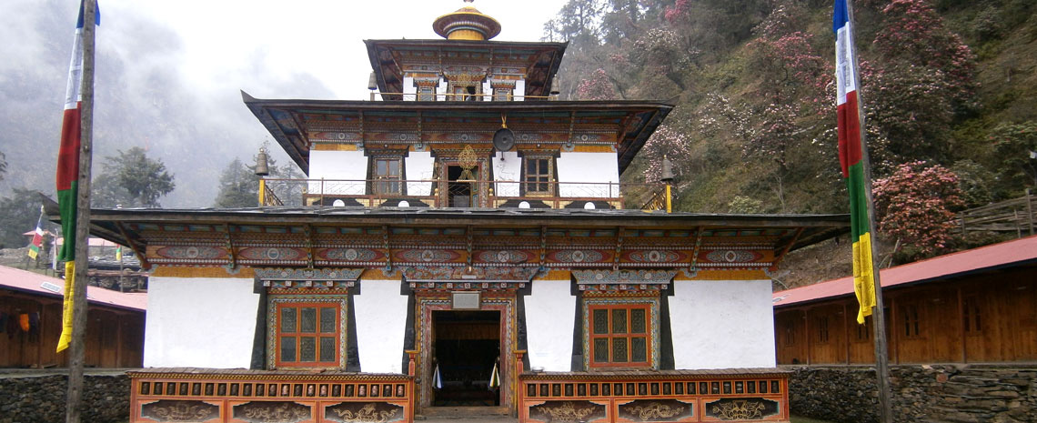 Serang Monastery – A unique Tibetan Buddhist Sanctuary in the Himalayas of Nepal
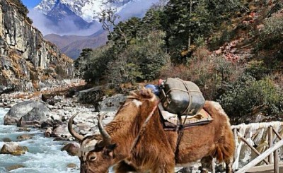
Serang Gompa, nestled on a small meadow in the midst of soaring Himalayan peaks, is Serang Gonpa, also famous as Nubri Monastery, a unique Tibetan Buddhist sanctuary. It is hard to imagine that this little refuge has existed for 500 years high on these harsh, southern slopes of the Himalayas at the border of Tibet and Nepal. The monastery is located above the Bhi Village on the route to the Manaslu Trek. Bhi Village is the closest human settlement for accommodation, other than camping.
The monastery has great Buddhist spiritual value for locals, where more than 3 dozen mountain kids are learning Buddhism. This side trip is done from Bhi Village. Set off from the lodge with adequate drinking water and food packed. Walk the steep uphill path into the pine forest to one of the hidden attractions in the area where hardly any trekkers visit. A day trip provides amazing scenery of the lush and green valley and the crests of Mount Manaslu, Ganesh Himal, and Siringi Himal. You’ll be rewarded with a close view of rare musk deer and Himalayan pheasants. If you have camping gear, the trek continues to Tsum Valley. The monastery is supported by the local community and the Kathmandu-based Kopan Monastery.
Kal Tal, meaning ‘Death Lake’ (3600m, 11808ft.)
Base point: Prok
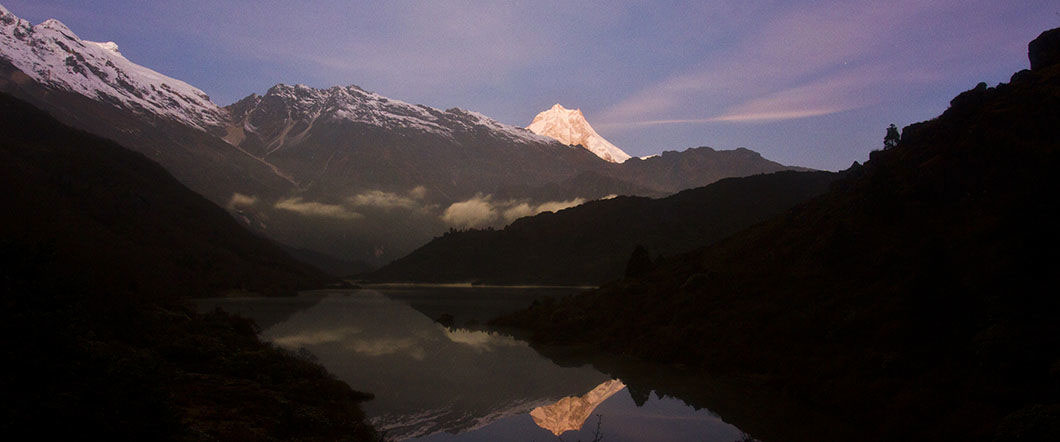
"Kal Tal" is usually translated as "Death Lake". Mount Manaslu is reflected on the lake at the nice evening sunset view. Photo @ Sherpana
This is a suggested day excursion to a mountain lake situated at an altitude of 3600 metres. It takes about 3-4 hours to get to the lake from the village of Prok. The mountain panorama from the lake is superb, but the effort is worth it only in clear weather. Note that in early autumn and late spring, clouds start to cover the mountains even early in the morning, so plan accordingly.
Hinang Gompa and Himalchuli Base Camp (4020m, 13186 ft)
Base point: Lihi
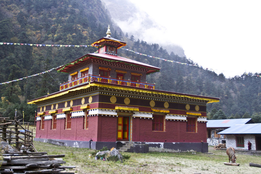 Hinang Gompa, a Buddhist Monastery which is on the way to Himalchuli Base Camp
It is an hour walk from Lihi Village (2900m) up to Hinang Khola that takes you to the large Hinang Gompa at the elevation of 3100 meters above sea level. The monks there are welcoming, and it is possible to sleep in the Gompa. Further on, the trail continues up towards the Himal Chuli range. The mountain views are spectacular, and you can visit the highly recommended Hinang glacier.
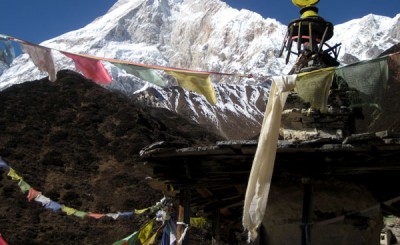
Phungen Gompa (Around 4050m, 11316ft)
Base point: Shyala or Samagaun
 Very impressive view of Manaslu from Pungyen Gompa – a day hike destination from Shyala or Samagaon
It is a day trip that starts in a branch of the trail between Shyala and Samagaon. From the branch, it takes about an hour to reach a yak pasture area and an additional one and a half hours to reach the Gompa, which is located at the end of a vast grassy plateau surrounded by dramatic mountain scenery. This is one of the best places to get a view of Mount Manaslu and its surroundings, but again, the effort is worth it only on a clear day. The Gompa includes a small prayer hall and some monk dormitories built into the mountain. There are no accommodation facilities here, but it looks like a tempting place for camping. Morning views from here will probably be awesome.
Birenda Tal (3450m, 11316ft)
Base point: Samagaun
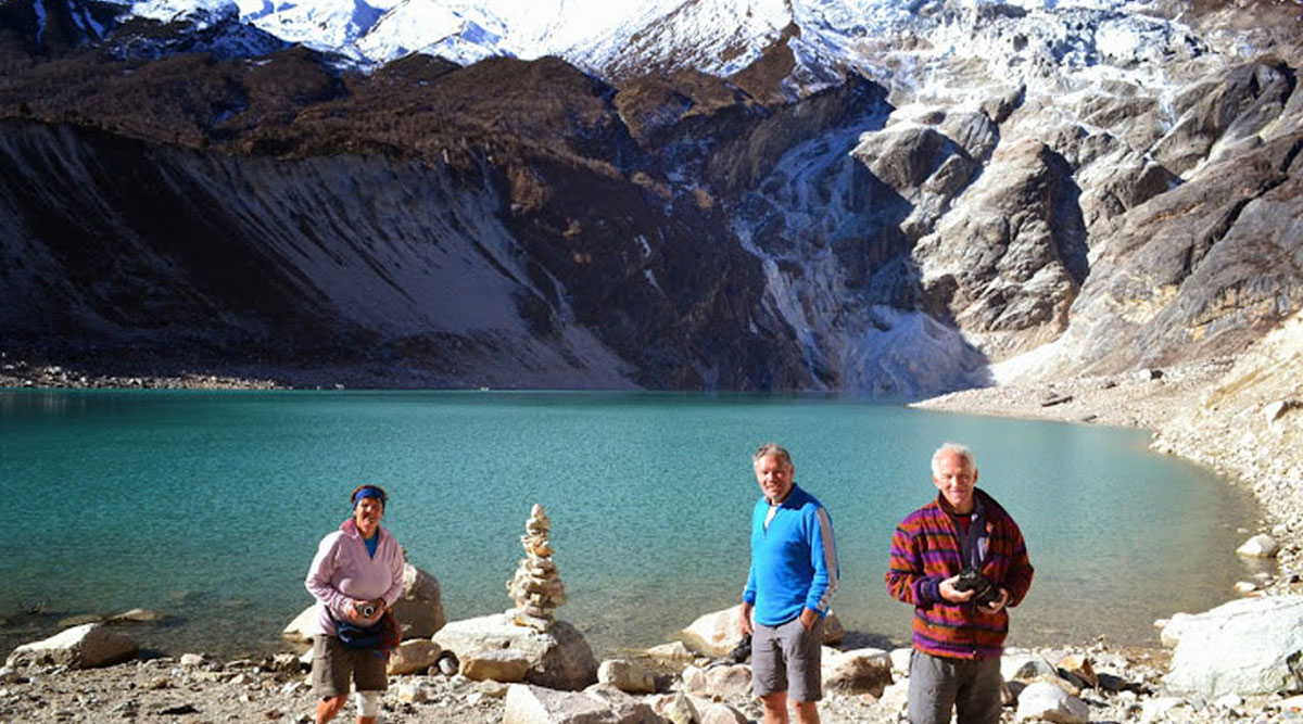
Birendra Lake at Samagaon
Birendra Tal, named after the late King Birendra of Nepal, is a turquoise lake at the foot of the Manaslu glacier. It can be reached by a 45-minute walk from Samagaon. Those of you who like to wash a bath in distant waters will find it pleasant to dip in its chilly, icy water. The lake can be visited on the way from Samagaon to Samdo, as it is a relatively short diversion from the Manaslu Circuit Trek main trail.
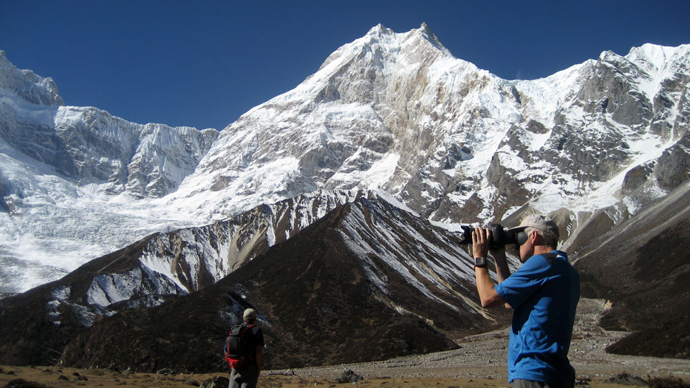
Manaslu Base Camp (4900m, 16072ft.)
Base point: Samagaun
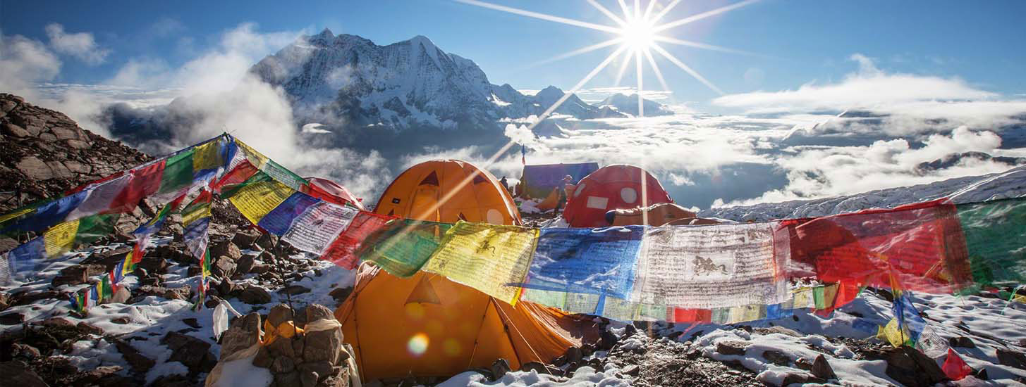 Manaslu Base Camp – climbers pitched tents and set the colourful prayer flags for good luck and successful summit of the mountain
Hiking to MBC at the altitude of 4900 meters from Sama Gaon takes a full day for a round. During the climbing seasons, the place is packed with tents, equipment, guides, porters and expedition members either anxious before the climb or exhausted after a climb. The steep climb from Sama Gaon takes about 4-5 hours. The trail has a short start in the forest and then becomes exposed on the steep slope above Samagaon, north of the impressive Manaslu glacier.
As you gain altitude, the scenery becomes more and more spectacular – the glacier is just nearby, the turquoise lake is beneath, and mountains are as far as the eye can see. The last part of the climb is the steepest on a slippery trail on a narrow moraine. Besides the experience of seeing the camp activity and meeting climbers, the surrounding mountain scenery is breathtaking. Although there are some glacier-based water sources on the way, carry enough water with you. Descending to Samagaon takes about 3 hours.
Rui La, Nepal –Tibet border (4998m, 16593 ft)
Base point: Samdo
From Samdo there are basically two options to get to the Tibetan border. Option one is seeing the view from Lajyung Bhanjyang, a pass at 5098 metres east of Samdo. The locals don’t suggest this option since it is not usually used and the trail is not clear (Yaks rule these hills and mark numerous trails there). Option two is the "main way to Tibet”, leading to a trade route to Tibet that goes through Rui La Pass at 4998 metres north of Samdo. The nearest Tibetan village is only a day's walk through this route, and a motorable road in the Tibetan side is two-days walk… It can be done on a long tourist walking day.
Rui La–Nepal–Tibet border. left Nepal and right to Tibet. Photo credit: @manaslutrailrace.org
The hike starts by going north from Samdo as if you are going to Dharamshala, crossing the Athahra Saya Khola, and climbing from the other side. But instead of going west towards Dharamshala, you continue north along the western side of the Athahra Saya Khola. The trail climbs gradually along the Athahra Saya Khola and then descends gently towards the riverbed, crossing a side river on a wooden bridge. It then climbs again and goes beside the river on its western side. After a 3-hour walk from Samdo, the Athahra Saya Khola turns west. On this point there is a small wooden bridge, and on the other side of it a clear slope that leads to distant mountain passes. Cross the bridge and begin to climb on the slope. At its bottom, the trail may seem unclear, as there are several Yak trails going up, but as you climb it is clear that your way is… up… The climb to the top of the Rui La Pass, at 4998, takes another 2 hours.
Along the way, there are beautiful sights of Manaslu in the distance, as well as the Hindu and Fukang glaciers just behind you as you climb. The Rui La pass is a "classic” "U"-shaped mountain pass. Prayer flags mark the pass, and a border stone marks the border between Nepal and "Dzong"—China. Numerous mountain ranges can be seen on the Tibetan side, and if you are patient enough, wait to see a Yak caravan crossing the pass to bring goods into Nepal. The way back to Samdo takes about 4 hours, so if you plan to do this trip, be prepared for a long day; start early and take a packed lunch and enough drinking water with you. If you include all these side trips, your Manaslu Trek itinerary will be 18 to 21 days.
Recent Post
-
Recommended Side Trips in Manaslu Trek
Uncategorized -
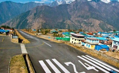
Lukla flight route changes
Uncategorized -
Nepal Reduced Everest Climbing Fee
Uncategorized -
Nepal Trekking Permit Increased
Uncategorized -
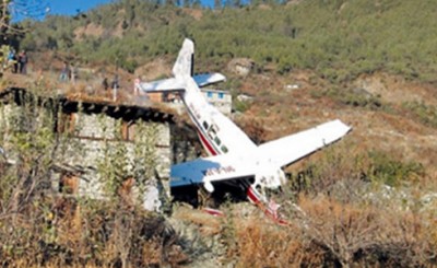
A plane with 18 passengers missing found crashed
Uncategorized -
Everest Base Camp Trekking
Uncategorized -
Everest Base Camp Trek - Winter 2013/2014
Uncategorized
Blog Category
Need Help?
Please feel free to contact us. We will get back to you with 1-2 business days. Or just call us now
+977 9851042153 [email protected]Associate Certifications
-

Registered with:
Company Registration Office, Government of Nepal -

Licensed by:
Nepal Tourism Board & Department of Tourism -

Member of:
Company Registration Office, Government of Nepal -

Member of:
Trekking Agencies Association of Nepal -

Affiliated with:
Wilderness Excursion Pvt. Ltd.